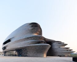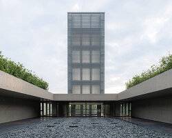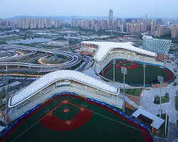
UAD has designed the ‘united nations geospatial information management forum’ located in a town, south of deqing county in china. built on an island on phoenix lake, the vast building comprises of an above-ground area of 458,069 ft2 (42,556 m2), with a main structure of three floors and a height of 78.58 ft (23.95 m). the project takes on an ellipsoid shape, which is consistent with the form of the island. in this way, the overall architecture matches well with the site environment and perfectly integrates with the surroundings.
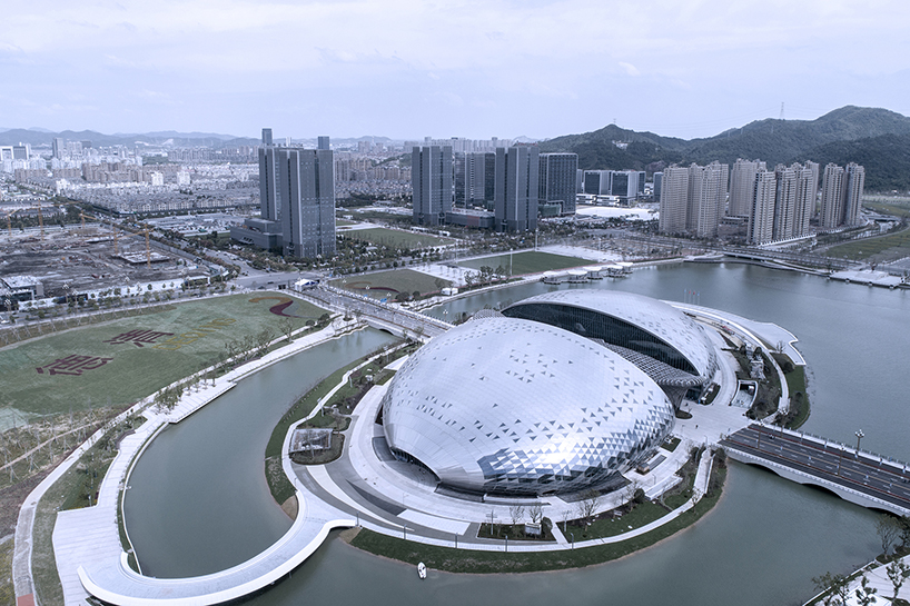
photo © cai jun
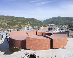
as a road passes through the land, the architect divided the building into two parts. in the east and west hemispheres, the main entrances of the conference center and grand theatre are set up separately, facing the lake and complementing the surroundings. the east hemisphere consists of the main venue for 2000 people, a multi-functional hall for 500 people, a small lecture hall for 300 people and several conference rooms, while the west hemisphere includes a grand theater for 1000 people and a cinema.

photo © zhao qiang
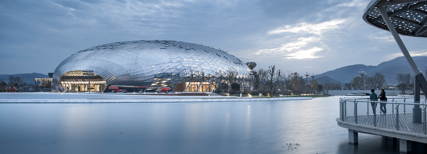
the design concept by UAD uses the imagery of a phoenix breaking through the clouds. the overall architecture aims to appear as a white glimmering cloud, lying on the lake and integrating with the surrounding environment. viewing the entire building from a distance, the form creates a distinct contrast, full of drama.
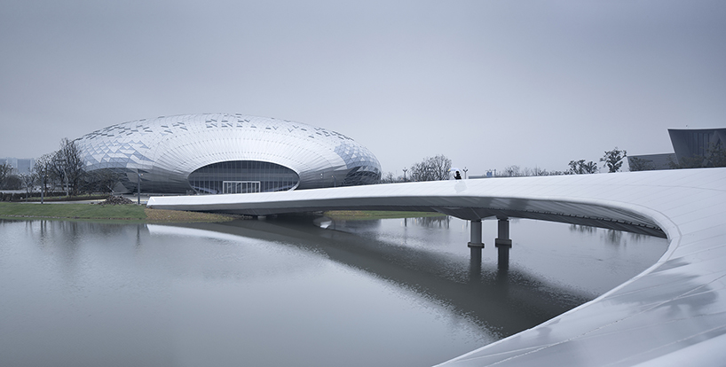
photo © zhao qiang
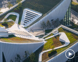
featuring simple structural forms, the interior aims to articulate an artistic concept of ‘woods and shades of bamboos nearby, mountains and flowing waters at distance.’ this is achieved by the emphasis of space, the combination of materials and the appropriate integration of local elements. the design attempts to reflect the local geographical features beyond a formal level, through flexible outdoor and indoor areas, and the dynamic exterior form of the architecture. overall, it is an urban public space, that welcomes guests from all over the world.

photo © zhao qiang

photo © zhao qiang

photo © zhao qiang

photo © zhao qiang

photo © zhao qiang

photo © zhao qiang
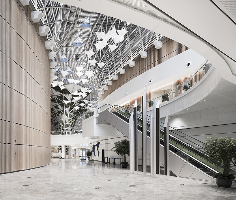
photo © zhao qiang

photo © zhao qiang

photo © cai jun
project info:
project name: ‘united nations geospatial information management forum permanent site of deqing county’
project location: deqing geographic information town, huzhou city, zhejiang province, china
architect: the architectural design & research institute of zhejiang university co., ltd
chief architects: wu zhenling, chen bing
design team: chen yu, zhu rui, zhang jiachen, fan zhenyue, cai xiaobing, fang tao
year of completion: 2018
construction area: 775,680 ft2 (72,063 m2)
client: management committee of science and technology new town, deqing county
partner: shanghai construction no.5 (group) co., ltd.
photography: zhao qiang, cai jun (2 aerial images)
designboom has received this project from our ‘DIY submissions‘ feature, where we welcome our readers to submit their own work for publication. see more project submissions from our readers here.
edited by: lynne myers | designboom